InterCEpter / AREIOM
A family of in-house multicopter platforms — from the original InterCEpter quadrocopter to the current AREIOM hexacopter — used to research and demonstrate autonomous flight control, sensor fusion, and mission management for embedded systems, with real-world application in automated infrastructure inspection
Purpose & Motivation
Autonomous drone operation for tasks like power-line or building inspection requires more than remote-controlled flight — it needs real-time sensor fusion, reliable low-level flight control, and intelligent mission planning working together, especially in environments (like near high-voltage lines) where standard GPS/compass navigation becomes unreliable. This platform was built in-house so every layer of the control architecture — from motor control to autonomous mission execution — stays open for research, modification, and testing, rather than relying on a closed commercial system.
Technical Description
InterCEpter (Quadrocopter)
- Four-motor platform; all attitude/position changes achieved purely through differential motor speed control (no separate control surfaces).
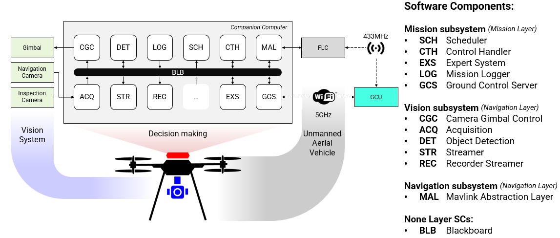
- Sensor fusion (accelerometers, gyroscopes) feeds a PID controller in the Flight-Control layer to compute motor speeds.
- Navigation-Control layer: GPS, 3D compass, ultrasonic/infrared distance sensors, built around a Texas Instruments LM3S2965 (ARM Cortex-M3) microcontroller.
- Mission-Control layer: originally run on an external computer; a DIMM-PC module was planned for onboard integration.
AREIOM (Adaptive Research Multicopter Platform)
- Demonstrator hardware: Hexcopter HP-Y6V2, Y6 geometry with coaxial (dual) rotors, modular and freely programmable control.
- Concrete hardware/software stack, developed and tested in the chair's Indoor Flight Center (IFC), which also provides a hardware/software-in-the-loop simulation environment:
- Flight-Control: Pixhawk hardware platform.
- Navigation-Control: Pixhawk hardware running ArduPilot software.
- Mission-Control: Odroid companion board for higher-level onboard processing.
- Architecturally, AREIOM separates functional layers by criticality and safety classification, and supports adaptive minimum-distance control, dynamic flight-path adjustment (e.g., around No-Fly zones), and much higher onboard compute than the original InterCEpter.
- Research techniques: FPGA-based hardware acceleration, hardware-software co-design for flight control and multi-sensor processing, real-time exploitation of high-resolution sensor data.
Capabilities
- Stable autonomous hover and GPS-waypoint navigation with adaptive obstacle/minimum-distance handling.
- Building and terrain inspection, and inspection of industrial assets such as high-voltage masts and transmission lines.
- Vision-based inspection demonstrations (wind turbines, photovoltaic systems, power lines) as part of the APOLI project.
- Aerial photogrammetry (2D/3D reconstruction, area documentation).
- Area exploration/surveillance and disaster-relief scenario demos (flooding, forest fire).
- Lightweight payload transport demos (e.g., small parcels, medicine).
- Operated both as a manually piloted testbed in the IFC and as an autonomous mission platform for algorithm validation.
Research Context
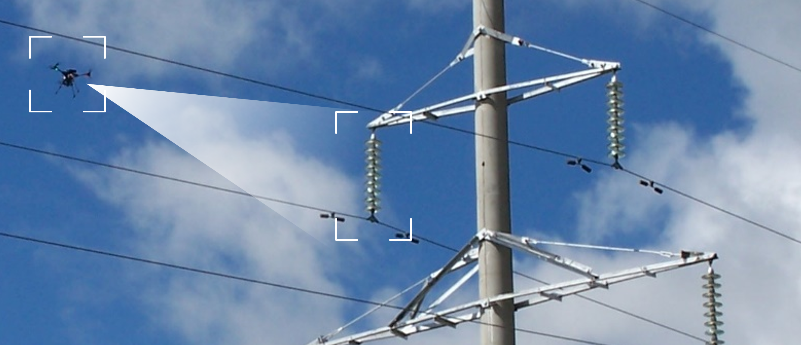
APOLI (Automated Power Line Inspection) — industry-funded case study (Q3 2016) to develop a highly automated, vision-based UAS inspection system for power distribution infrastructure, focused on damage detection in insulators, poles, and transmission lines. Because conventional GPS/IMU/compass navigation is unreliable near high-voltage electromagnetic fields, APOLI relies on vision-based flight control with real-time obstacle/target detection and an onboard mission control that autonomously supervises the flight path — this is a direct downstream application of the AREIOM platform's navigation and mission-control architecture.